Maritime Situational Awareness Without Blind Spots
Detect dark vessels, track oil spills, and protect offshore assets with continuous, high-resolution maritime monitoring
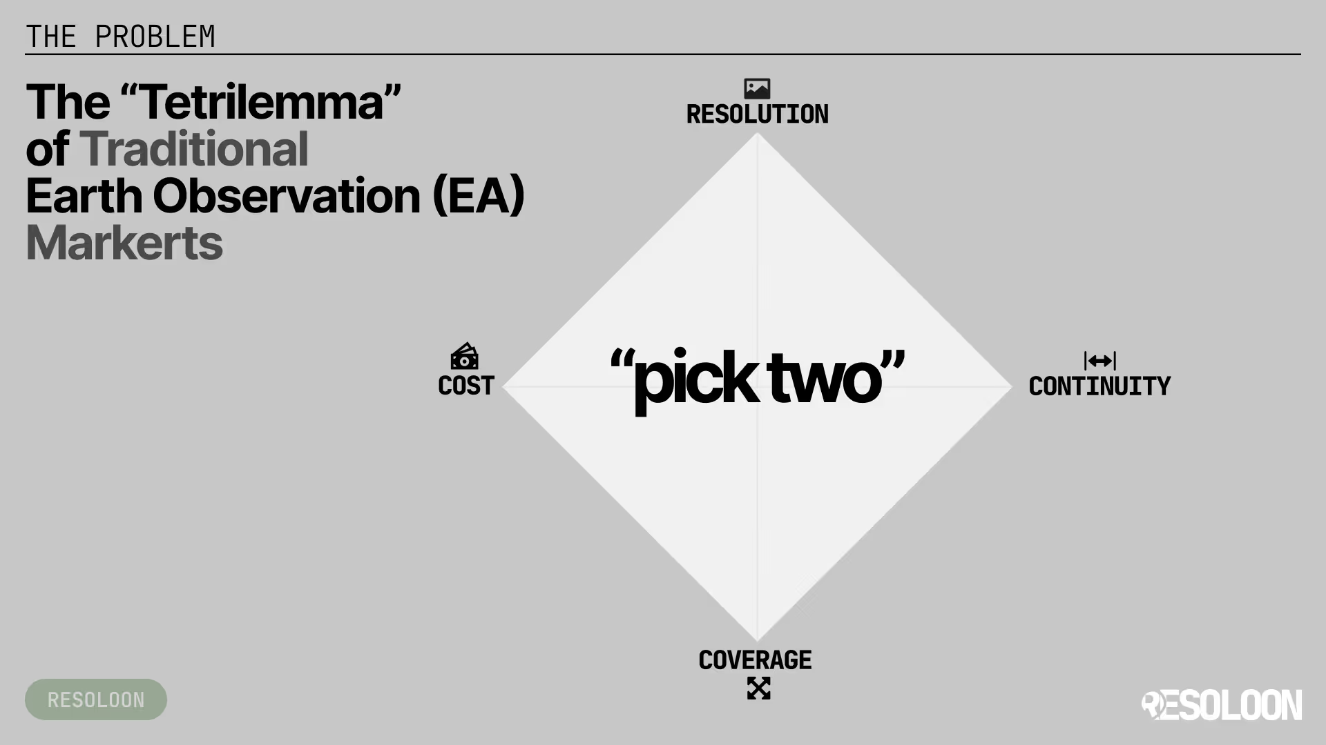
Did you know the whole market forces you into bad trade-offs?
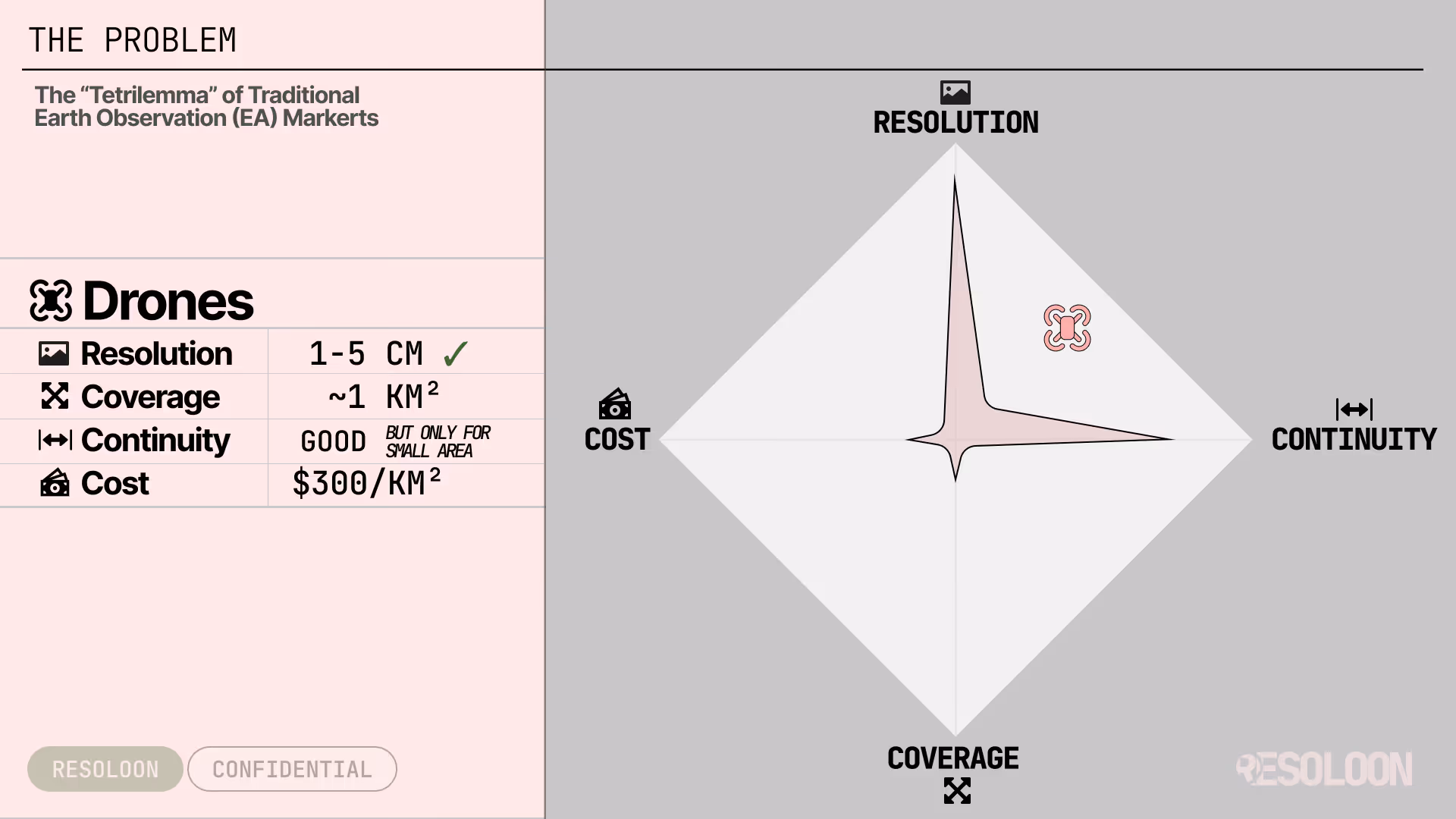
Drones
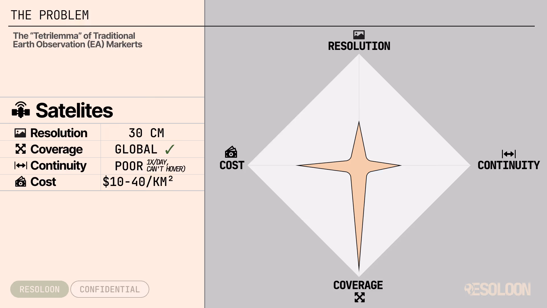
Satellites
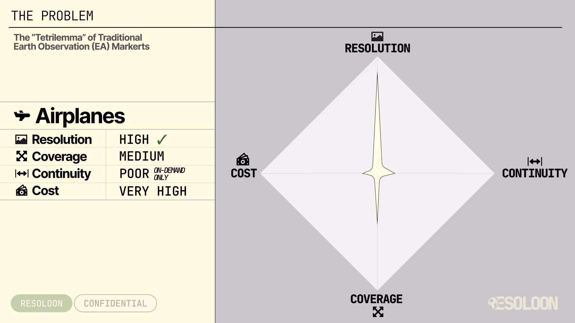
Airplanes
Why Maritime Situational Awareness still has blind spots
Pick two. You always lose the third.
Whether you rely on satellites, patrol aircraft, drones or radar, you’re forced into the same trade-off:
You can’t have wide-area coverage, high resolution, continuous monitoring, and reasonable cost at the same time.
Drones
Amazing detail.
Tiny coverage.
Expensive per km².
They scale poorly and require constant human operations.
Great for close-ups, but impractical for continuous, large-area intelligence.
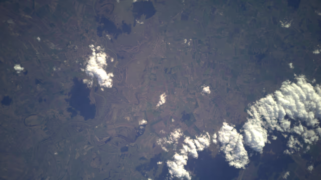
Satellites
Great coverage.
Low revisit.
Limited detail or high cost.
You get snapshots, not presence.
Either the data is cheap and coarse - or detailed and expensive, with long gaps between updates.
Patrol aircraft
Flexible and powerful, but extremely expensive and not scalable for continuous monitoring.

The result: dark vessels slip through, incidents are detected late, and offshore assets remain exposed.
Resoloon is built to change this.

Related Posts

Why Earth Observation Is Expensive & How Resoloon Fixes ItQuick introduction
Traditional satellite imagery forces you to choose between cost, coverage, and detail. Resoloon delivers high-resolution monitoring without the tradeoffs.

Why Earth Observation Is Expensive & How Resoloon Fixes ItQuick introduction
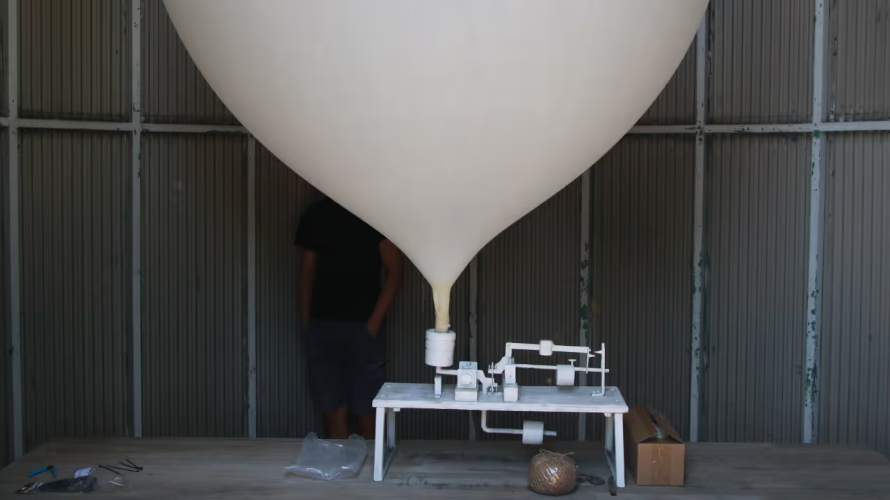
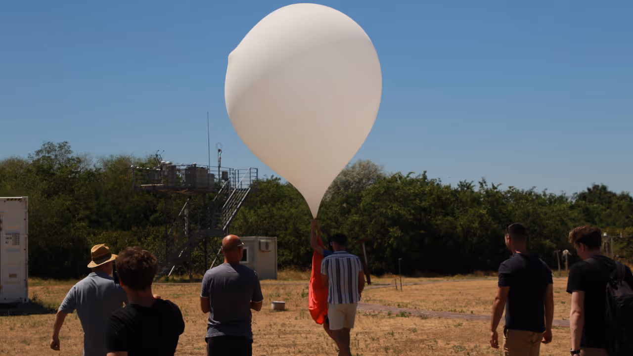
Discover how Resoloon made the Forbes 30 Under 30 2026 list. From high-altitude balloons to the Forbes cover, go behind the scenes of our startup journey.
Built for Maritime Situational Awareness

Detect dark vessels and unauthorized boats before they become a security risk

Persistent, navigable operations over the sea - not just snapshots
High-resolution imagery over large sea areas

Track oil spills and environmental incidents as they evolve

Protect offshore assets like wind farms and oil rigs with continuous oversight
Meet our team

Worked on autonomous underwater quality assurance submarines.

Worked in advisory and in startups.

Theoretical physicist who worked on airplane navigation optimization

Built precision embedded data processing systems.

Built space grade electronics and military drones.

Designing and building hardware systems
Book a short discovery call
with us to walk through your area, your constraints, and your goals. We’ll tell you honestly whether Resoloon is a good fit - and if it is, we’ll outline a pilot setup tailored to your needs.
What Happens After You Book a Call
Quick introduction
We start by understanding
what area you’re responsible for, and
what problem you’re trying to solve.
Your problem & constraints
You walk us through:
what you’re monitoring today
what’s not working with your current setup
what matters most: resolution, coverage, speed, cost, or continuity.
We map possible solutions
Based on your use case, we explain:
whether Resoloon is a good fit
how a pilot could look for your area
what’s realistic today - and what’s not (we’ll be honest)